

This site uses cookies. By continuing to browse the site you are agreeing to our use of cookies
Copyright © Ben More Webcam and Ochils Mountaineering Club

Loading...
Loading...

Want super fast fibre broadband in Crianlarich?? You’ll need to ‘express your interest’ with BT by filling in this form
Location
Crianlarich is a small village located in the southern highlands of Scotland on the A82/A85 approximately 11KM NNE of Loch Lomond. It is located within the ‘Loch Lomond and the Trossachs National Park’.
Getting To Crianlarich
Whether by road or rail or indeed, on foot, Crianlarich is easy to get to. The local train station in the village offers services to Glasgow, Oban and Fort William; the A82 (from Glasgow/Fort William) and A85 (from Stirling) intersect in the village and ensure the village is well connected via road. The infamous West Highland Way passes very close to the village making Crianlarich a popular overnight stop.
Village Facilities
- Londis Shop Website
- Rod and Reel Pub (food) Website
- Ben More Hotel and Bar (food) Website
- Train Station Website
- Hotels
- Youth Hostel Website
- Police Station (Tel: 01877 330222)
- Post Office (in the shop)
Things To Do
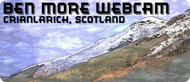
Hill Walking: Cruach Ardrain, Beinn Tulaichean, Ben More, Stob Binnein, Ben Challum, Meall Glas, and Sgiath Chuil are within walking distance while the Arrochar Alps, Ben Lawers, Ben Lomond, Beinn Dubhchraig, Ben Oss, Ben Lui and the Bridge Of Orchy hills are a short drive away. Within 25KM of Crianlarich (as the crow flies) you will find 30-
Winter Climbing: Beinn Udlaidh, Beinn an Dothaidh and Ben Lui are within easy reach, with Glencoe a bit further.
Road Cycling: There are many possibilities for road cycling in the area. For a short loop, try Glen Orchy (56KM), for a longer loop, cycle around Loch Awe (150KM) (could also use train/car to shorten this [to 100KM] by starting at Dalmally). For some hills to grind up, try a loop through Tarbet (Via A82) and the Arrochar Alps returning via Inveraray, Dalmally &Tyndrum (112KM). Beware that the A82 is busy/narrow. Set off early, or use the train (Crianlarich–>Tarbet)!
Climbing: Glen Coe and Glen Etive or for sport climbers, new routes have been developed in Glen Ogle. Further afield, Benny Beg offers more sports routes.
Mountain Biking:
Loch Lyon Loop: Start at Tyndrum. Join the WHW at the Tyndrum Shop (Streetview Link). Head up the hill, soon enough you’ll be off-